
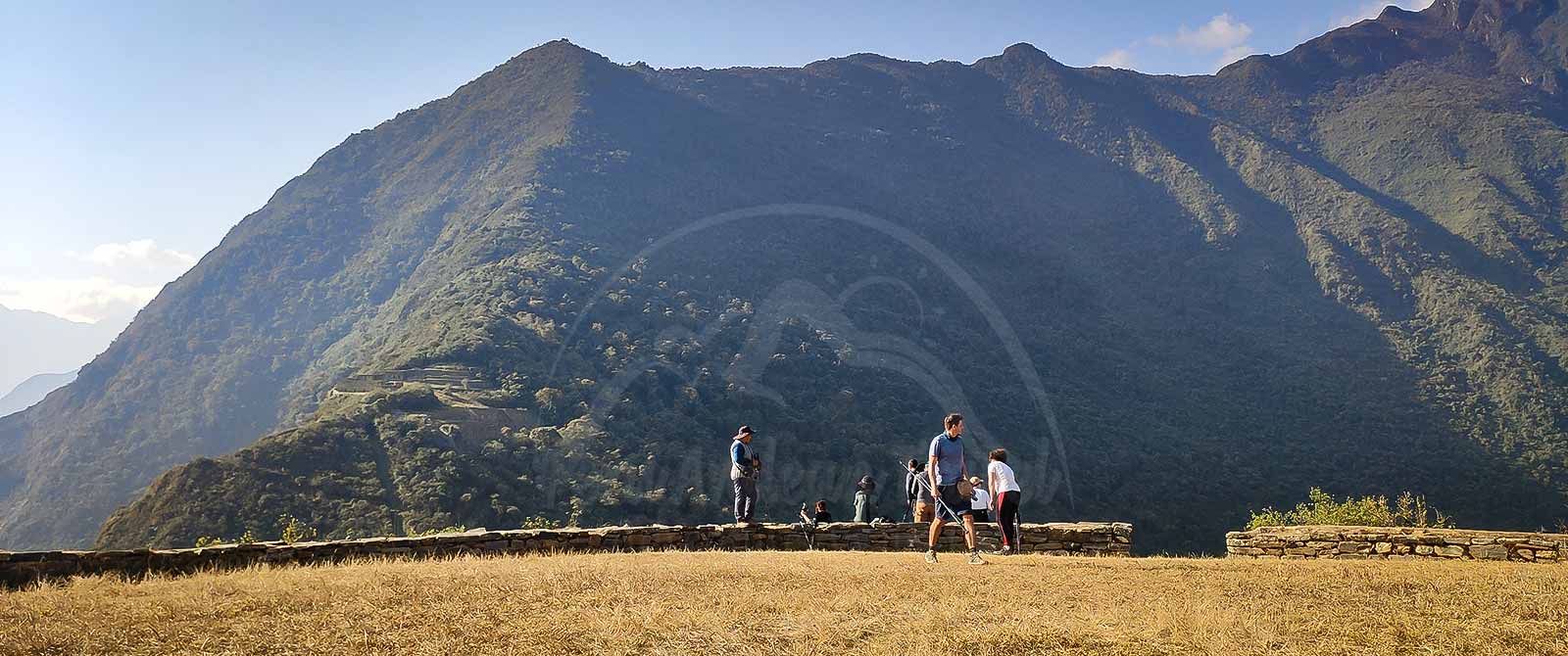
There are several Choquequirao trekking routes, but none of them can be reached by road all the way to the archaeological site, and there is no train service to Choquequirao. At present, the only way to reach this remote Inca city is on foot.
The rugged geography surrounding the Choquequirao Archaeological Park makes access challenging. For this reason, the traditional way to reach this remarkable destination in the Peruvian Andes is to hike through the Apurímac Canyon and climb the mountain slopes toward the archaeological site.
The main access points to Choquequirao are located in different areas. There are three main Choquequirao Trekking Routes. The most popular route starts near Cachora, the second approaches from Huanipaca via Kiñualla, and the third begins in Yanama. Each route offers a different experience, with its own landscapes, challenges and logistical requirements.
Choquequirao Trekking Routes
1. Cachora to Choquequirao Route
The Cachora to Choquequirao route is the best-known and most frequently used trail. Every year, many visitors choose this route to explore the archaeological complex. It is a beautiful trek that crosses several altitude zones, each with its own characteristic flora and fauna.
Today, the hike usually starts at Capuliyoc and covers approximately 21 km one way to Choquequirao, for a total of around 42 km round trip. A typical itinerary takes two days to reach the archaeological site and another two days to return. However, hiking times vary depending on fitness level, weather conditions and terrain. Walking one kilometer downhill is very different from climbing the same distance uphill.
The route begins at Capuliyoc, at approximately 2,900 meters above sea level. From there, the trail descends to Rosalina Beach, at around 1,500 meters, before climbing again to approximately 3,100 meters at Choquequirao. These major elevation changes make this one of the most demanding treks in the Cusco region.
Advantages
- Spectacular landscapes: Enjoy impressive views of the Apurímac Canyon, one of the deepest canyons in the world.
- Different ecosystems: Experience a variety of landscapes, vegetation and wildlife throughout the Choquequirao Trek.
- Logistical support: Along the traditional route, you can find campsites, basic accommodation, mule rental, muleteer services and small shops where you may be able to buy water and snacks.
- Tour options: Many travel agencies offer the traditional Choquequirao trek with different service levels and itineraries.
- An extraordinary archaeological destination: Explore Choquequirao, an important Inca site often compared with Machu Picchu because of its historical significance and spectacular mountain setting.
Disadvantages
- Good physical fitness is required to complete this demanding hike.
- The steep terrain, rugged geography and changing weather conditions make the trek challenging.
- Mobile phone coverage and internet access are generally unavailable along much of the trail. Connectivity may be available at some camps or accommodation sites, but it should not be relied upon.
- If you travel independently, you must plan carefully because services between campsites are limited. Carry enough water, food and snacks for each section of the route.
Recommendations
- Spend at least two or three days acclimatizing in Cusco or another suitable location before starting the trek.
- If traveling independently, research the distances, campsites, water sources and facilities along the entire route.
- Avoid hiking at night. This precaution can help prevent serious accidents on steep and uneven terrain.
- Prepare your legs and cardiovascular endurance with long walks and uphill training before the trip.
- Carry a headlamp or flashlight, a personal first-aid kit and a reusable water bottle.
- Bring insect repellent.
- Use trekking poles to help manage steep ascents and descents.
- Pack lightweight clothing for warm daytime conditions and warm layers for cold nights.
- Wear sturdy trekking boots that you have already used and tested.
- Whenever possible, plan your trek during the drier months, generally from April to November. The rainy season usually runs from December to March, although weather conditions can vary.
2. Huanipaca–Kiñualla to Choquequirao Route
This is an alternative route to Choquequirao for hikers looking for a quieter and less-traveled trail.
To reach the starting point, you must travel to Kiñualla, which can be accessed by road from Cusco or Abancay. From this area, you can already see the Inca city of Choquequirao across the vast Apurímac Canyon.
The hike from Kiñualla to Choquequirao Archaeological Park covers approximately 15 km. Some experienced hikers may complete the route in one day, but it is more demanding than it may appear because of the steep elevation changes.
Kiñualla is located at approximately 3,000 meters above sea level. From there, the trail descends to San Ignacio Beach, at around 1,550 meters. The path is generally more accessible and in better condition during the dry season, particularly from April to November.
From San Ignacio Beach, the trail climbs toward the Choquequirao Archaeological Park, located at approximately 3,100 meters. This is the most demanding section of the hike because of its steep slopes and narrow sections of trail.
If you plan to return along this route, it is advisable to start early and descend toward San Ignacio. Arrange your road transportation from the San Ignacio area in advance, confirming the exact meeting point and departure arrangements with your driver or local contact before beginning the hike.
Advantages
- Peace and quiet: This route is less crowded than the traditional Cachora–Capuliyoc trail.
- Different canyon views: Discover a different perspective of the impressive Apurímac Canyon.
- Authentic Andean communities: Pass through rural villages where contact with international visitors is less frequent.
- A shorter distance: The route is shorter in kilometers than the traditional approach from Capuliyoc, although the steep slopes make it physically demanding.
- A chance to disconnect: If you want to escape busy tourist routes and enjoy nature in a more remote setting, this trek may be an excellent choice.
Disadvantages
- A good level of physical fitness is necessary because of the steep ascents and descents.
- Tourist facilities and services are limited due to the lower number of visitors.
- There are fewer camping options along the trail.
- Logistical support is more limited than on the Cachora route, including mule rental, muleteers, campsites and places to obtain water or food.
- Independent hikers need to plan their supplies and transportation carefully.
Recommendations
- Prepare physically before undertaking this challenging adventure.
- Bring appropriate equipment, including trekking poles, sturdy hiking boots, a suitable backpack and clothing for changing weather conditions.
- Research the trail, distances, elevation changes and available services before departure.
- Whenever possible, travel with a professional guide or an experienced travel agency familiar with the route.
- Carry water-purification supplies and extra snacks in case you cannot find provisions along the way.
- Always bring a headlamp or flashlight and a personal first-aid kit.
- Consider returning via the Cachora route if your itinerary, transportation and trekking arrangements allow it.
- For greater safety, choose a period with generally drier weather, usually between April and November, while checking local trail conditions before departure.
3. Yanama to Choquequirao Route
The Yanama to Choquequirao route can be considered one of the most demanding approaches because of the rugged geography and significant elevation changes along the way.
It is an option for experienced hikers who are already in Santa Teresa or the surrounding area and want to explore another remarkable archaeological destination in the Peruvian Andes.
The trek starts in the village of Yanama, and the distance to Choquequirao is approximately 25 km. The main challenges include the steep ascents and descents, changing weather conditions and the state of the trail.
If you reach Choquequirao via the Yanama route, continuing toward Capuliyoc and exiting in the direction of Cusco or Abancay may be a more practical option than returning to Yanama. However, this decision depends on your itinerary, trail conditions and available transportation.
Yanama lies at approximately 3,640 meters above sea level. From the village, the trail climbs to Abra de San Juan, a mountain pass at around 4,150 meters. The route then descends toward the Río Blanco, at approximately 1,850 meters.
Although this descent is physically demanding, it rewards hikers with impressive panoramic views of the surrounding mountains and the Apurímac region.
From Río Blanco, the trail climbs again toward the Choquequirao Pass, at approximately 3,500 meters. From there, hikers descend to the Choquequirao Archaeological Park, located at around 3,100 meters.
After crossing these challenging mountain landscapes, you arrive at Choquequirao, one of the most remarkable Inca archaeological sites in the Andes and a destination often associated with the last strongholds of the Incas.
Advantages
- Outstanding mountain scenery: Enjoy spectacular natural landscapes and views of the snow-capped peaks of the Vilcabamba mountain range.
- Remote mountain exploration: Discover remote mountain areas and, where access is permitted and conditions allow, learn about the region’s history of small-scale mining.
- Rich biodiversity: Explore a mountain environment with diverse vegetation and wildlife.
- A longer adventure: This route can form part of a more extensive trekking itinerary toward Machu Picchu, provided the connecting trails, permits and logistics are confirmed in advance.
- Historic trails: Some sections offer landscapes and trail characteristics reminiscent of the Inca road network.
Disadvantages
- The route requires excellent physical preparation because of the substantial elevation changes.
- Hiking at high altitude, especially near Abra de San Juan, may cause altitude sickness.
- Camping areas are limited, and suitable overnight locations must be planned in advance.
- Services along the route are scarce or unavailable in some sections.
- Because relatively few hikers use this trail, insects and mosquitoes can be a problem, particularly near Río Blanco.
Recommendations
- Plan the entire trek carefully, including daily distances, elevation changes, overnight stops and emergency options.
- Purchase and organize essential supplies in Yanama, the last significant place to stock up before continuing toward Maizal, where provisions may be difficult to find.
- Consider joining a trekking group rather than traveling alone through this remote area.
- Allow enough time to acclimatize and assess your fitness before attempting the high mountain passes.
- Bring suitable trekking equipment, sufficient food, water-purification supplies, insect repellent and a first-aid kit.
- Check trail conditions and arrange local guidance before departure.
- If your itinerary permits, consider continuing toward Capuliyoc rather than returning to Yanama, but confirm the route and transportation arrangements beforehand.
Which Choquequirao Hiking Route Should You Choose?
Each of the three routes offers a different way to discover Choquequirao. The best option depends on your fitness level, available time, trekking experience and the kind of adventure you want.
- Cachora–Capuliyoc route: A popular choice for travelers who want to follow the traditional approach, with a more established trekking itinerary and greater logistical support.
- Huanipaca–Kiñualla route: An alternative for hikers seeking a quieter trail and a different perspective of the Apurímac Canyon. The steep terrain still requires good physical preparation.
- Yanama route: A challenging option for experienced trekkers interested in remote mountain landscapes and longer adventures in the Vilcabamba region.
Whichever route you choose, remember that Choquequirao is a remote archaeological destination. Careful planning, appropriate equipment, acclimatization and up-to-date information about local conditions are essential for a safer and more rewarding experience.